Filtrer les publications
Ces tempêtes extrêmes que l'histoire ne nous a pas encore dévoilées
Les études d'aléa de submersion marine s'attachent à définir des valeurs extrêmes pour les niveaux marins et les houles et à combiner ces valeurs afin de produire un aléa de référence à la côte. Pourtant, ces phénomènes résultent souvent d'un même événement météorologique générateur : les tempêtes. Météo-France, le Cetmef et le Shom ont uni leurs efforts pour étudier les tempêtes menaçant le littoral breton et déterminer des événements extrêmes, dont on déduirait les paramètres hydrodynamiques pour l'étude des risques de submersion marine.
D. Goutx, F. Baraer, A. Roche, G. Jan
Date de sortie 14/05/2014
Date de sortie 14/05/2014
La Houille Blanche, volume 100
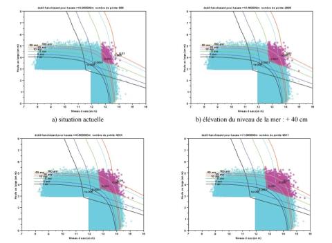
Évolution des périodes de retour des évènements franchissant avec le changement climatique
L'une des conséquences du changement climatique est la remontée du niveau moyen des mers. C'est cette conséquence qui est prise pour hypothèse principale dans ce travail. La méthode utilisée pour déterminer l'évolution des franchissements s'appuie sur deux sites d'études sur le littoral français : Deauville et Saint Malo.
G. Prevot, X. Kergadallan, P. Sergent
Date de sortie 14/05/2014
Date de sortie 14/05/2014
La Houille Blanche, volume 100
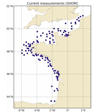
PREVIMER: Improvement of surge, sea level and currents modelling
The pre-operational system PREVIMER provides coastal observations and forecasts along French coasts. It provides, among other variables, currents, sea levels, surges and waves. This paper describes the development and validation of a high temporal (15 minutes) and spatial (250 m) resolution modeling system, based on MARS hydrodynamic model (Lazure and Dumas 2008), along the Atlantic and English Channel coasts.
L. Pineau-Guillou, F. Dumas, S. Theetten, F. Ardhuin, F. lecornu, J.-F. Le Roux, D. Idier, H. Muller, R. Pedreros
Date de sortie 29/04/2014
Date de sortie 29/04/2014
Mercator Ocean
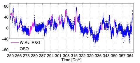
Sea level surges of June 2011 in the NE Atlantic Ocean: observations and possible interpretation
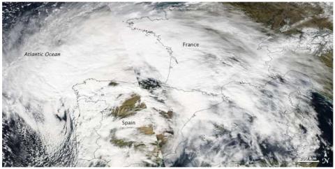
We present a synthesis of tide gauge data recorded on June 26–28, 2011, along the NE Atlantic and the English Channel coastlines, which show a significant sea level disturbance observed from Portugal to England during several hours. Though the amplitude was low (a few centimeters at most), the main disturbance was observed in about 30 harbors. The phenomenon started in south Spain and Portugal in the last hours of 26 June and reached the French west coastline on 27 June, at about noon.
A. Frère, C. Daubord, A. Gailler, H. Hébert
Date de sortie 21/03/2014
Date de sortie 21/03/2014
Natural Hazards, volume 74

Sea level time series and ocean tide analysis from multipath signals at five GPS sites in different parts of the world
We present sea level observations derived from the analysis of signal-to-noise ratio (SNR) data recorded by five coastal GPS stations. These stations are located in different regions around the world, both in the northern and in the southern hemisphere, in different multipath environments, from rural coastal areas to busy harbors, and experience different tidal ranges.
J. S. Löfgren, R. Haas, H.-G. Scherneck
Date de sortie 11/03/2014
Date de sortie 11/03/2014
Journal of Geodynamics, volume 80
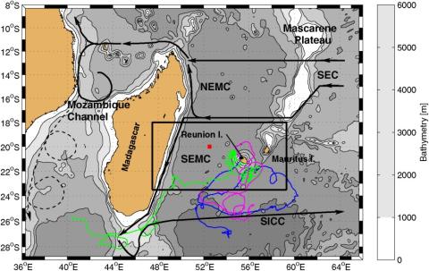
Circulation around La Réunion and Mauritius islands in the South-Western Indian Ocean: a modeling perspective
The objective of this study is to document the circulation in the vicinity of La Réunion and Mauritius islands, i.e., within 500 km offshore, on the intraseasonal time scale, using a high-resolution realistic modeling strategy. The simulated sea level anomalies, water mass properties, and large-scale circulation compare favorably with satellite and in situ observations. Our high-resolution simulation suggests that the currents around the islands are maximal locally, oriented southwestward, to the southeast of both islands which is not visible in low-resolution satellite observations.
S. Pous, P. Lazure, G. André, F. Dumas, I. Halo, P. Penven
Date de sortie 03/03/2014
Date de sortie 03/03/2014
JGR Oceans
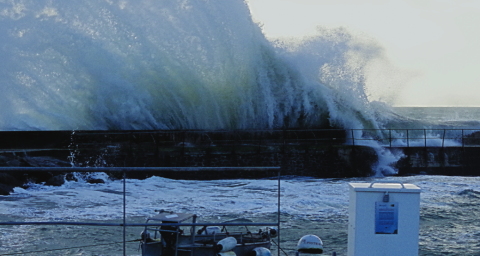
Caractérisation de 7 évènements de tempête automne-hiver 2013-2014
Le littoral Atlantique-Manche-Mer du Nord a été balayé par une série de tempêtes assez remarquables cet automne-hiver 2013-2014 (Christian, Godehard, Xaver, Dirk, Petra) engendrant parfois des dégâts considérables. Les observations de niveau de la mer disponibles au SHOM ont été analysées pour caractériser ces événements. L’analyse des mesures marégraphiques, ainsi que l’exploitation des niveaux extrêmes calculés statistiquement, ont permis d’estimer les périodes de retour des niveaux marins atteints pendant ces événements, sur l’ensemble des côtes.
C. Daubord
Date de sortie 01/02/2014
Date de sortie 01/02/2014
Shom
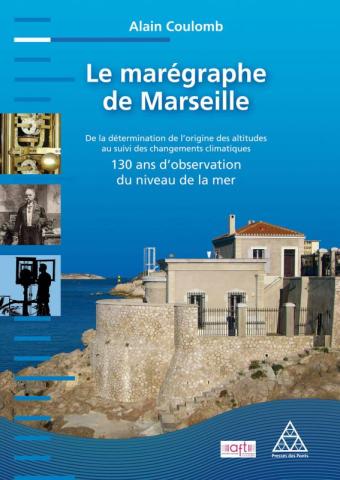
Le marégraphe de Marseille
Observatoire du niveau de la mer assez méconnu, le marégraphe de Marseille a été construit à la fin du XIXe siècle pour fixer le niveau zéro au-dessus duquel sont exprimées les altitudes du territoire français continental. Il abrite un instrument d’enregistrement, dit « marégraphe totalisateur », encore en parfait état de fonctionnement et aujourd’hui unique au monde dans sa catégorie.
A. Coulomb
Date de sortie 01/01/2014
Date de sortie 01/01/2014
AFT - Presses des Ponts
GPS observation of geophysical deformations induced by non tidal loading
The temporal and spatial redistribution of the environmental masses deform the surface of the Earth. These deformations are observable by space geodetic techniques such as GNSS. Since highly accurate IGS satellite and clock data are available and sophisticated algorithms have been developped, the integer fixed ambiguity Precise Point Positioning (iPPP) method opened a new era for the Global Navigation Satellite System (GNSS) analysis and its application in geophysical studies.
M. Ferenc
Date de sortie 2014
Date de sortie 2014
Laboratoire Géomatique et Foncier - Paris, CNAM