Rechercher
Modelling the annual primary production of an intertidal brown algal community based on in situ measurements
Intertidal communities dominated by canopy-forming brown algae (Phaeophyceae) usually prove to be highly productive systems, based on short-term measurements. However, long-term metabolism (…

Modeling dependence and coincidence of storm surges and high tide: methodology, discussion and recommendations based on a simplified case study in Le Havre (France)
Coastal facilities such as nuclear power plants (NPPs) have to be designed to withstand extreme weather conditions and must, in particular, be protected against coastal floods because it is the…
Assessing the Role of Storm Waves and River Discharge on Sediment Bypassing Mechanisms at the Têt River Mouth in the Mediterranean (Southeast France)
River mouths along sandy coastlines are influenced by alongshore transport of littoral sands and the interaction of hydrodynamics processes at the river mouth. These interaction are responsible…
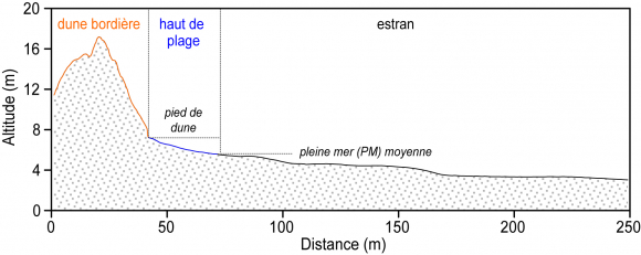
Impacts des séries de tempêtes de 2013 à 2018 sur l’évolution récente des cordons dunaires du nord de la France
Dans cet article, nous étudions l’évolution des cordons dunaires à l’est de Dunkerque, au nord de la France, sur une période s’étalant de novembre 2012 à février 2018. Elle se base sur l’analyse…
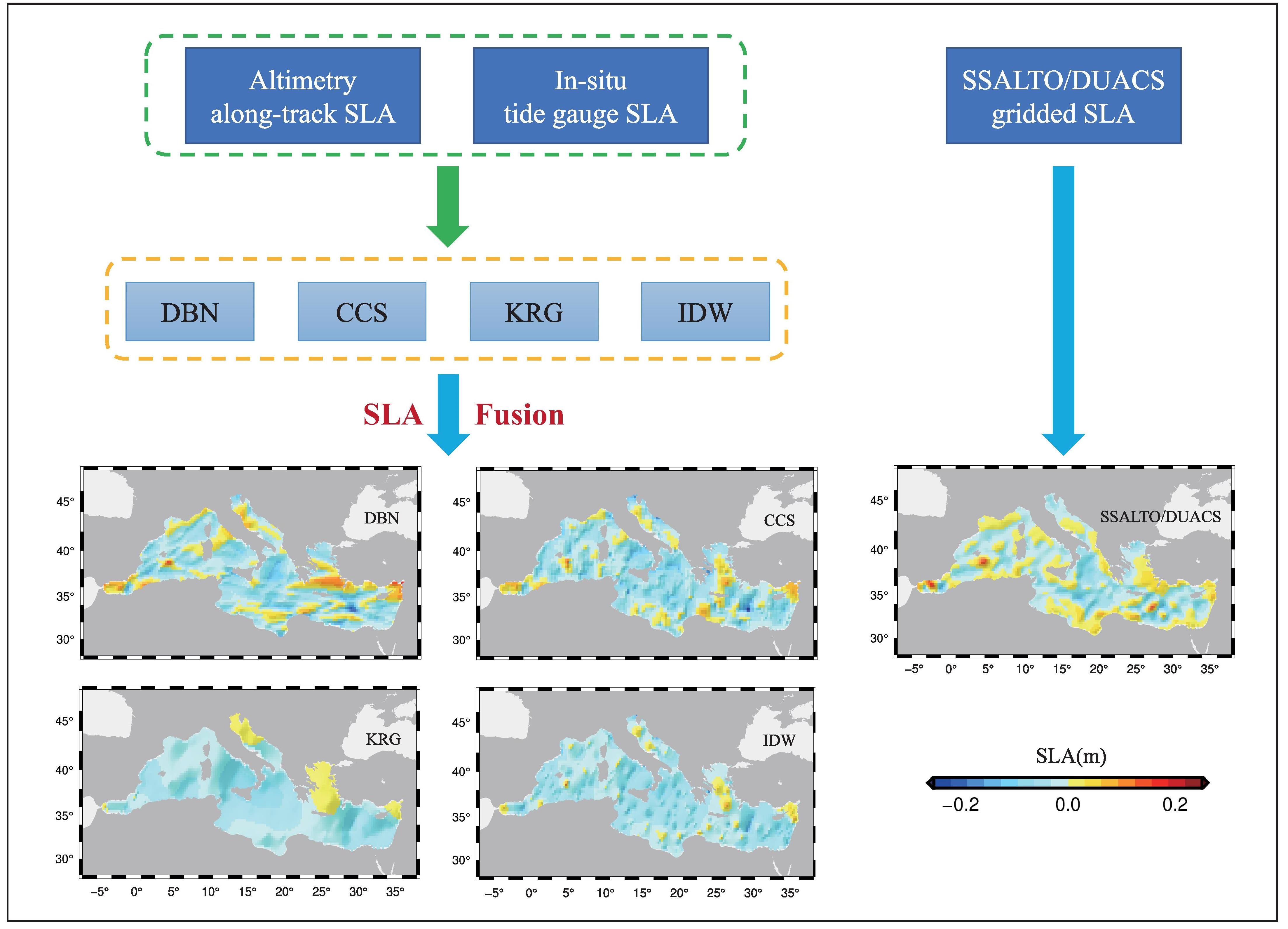
Sea Level Fusion of Satellite Altimetry and Tide Gauge Data by Deep Learning in the Mediterranean Sea
Satellite altimetry and tide gauges are the two main techniques used to measure sea level. Due to the limitations of satellite altimetry, a high-quality unified sea level model from coast to open…
Assessment of the Shoreline Evolution at the Eastern Giens Tombolo of France
Giens double tombolo linking Giens island to the mainland is a unique geomorphological formation in the world. However, its existence has been threatened by coastal erosion, especially in the…

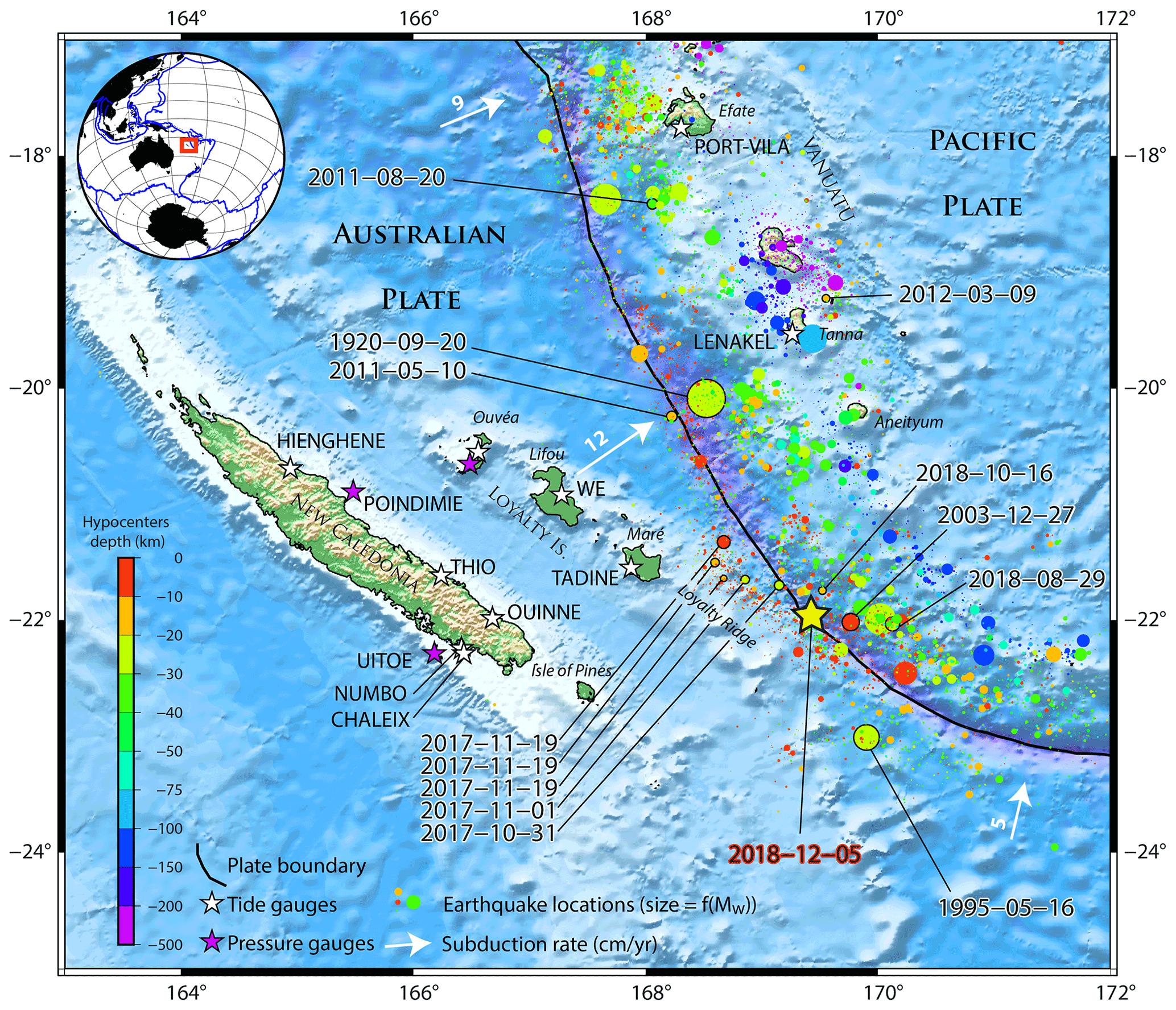
The Mw 7.5 Tadine (Maré, Loyalty Islands) earthquake and related tsunami of 5 December 2018: seismotectonic context and numerical modeling
On 5 December 2018, a magnitude Mw 7.5 earthquake occurred southeast of Maré, an island of the Loyalty Islands archipelago, New Caledonia. This earthquake is located at the junction…
Wave overtopping and overflow hazards: application on the Camargue sea-dike
Dike breaches occurs regularly during storm events. This phenomenon contributes to amplify considerably the impact of floods on coastal areas. It represents an important cost for repairing…
Improving storm surge and wave forecasts from regional to nearshore scales
Submersion risks assessment requires different tools and methods from regional to coastal scales. The Shom’s strategy relies on numerical modelling and observational systems applied in a…
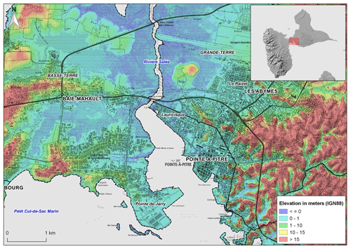
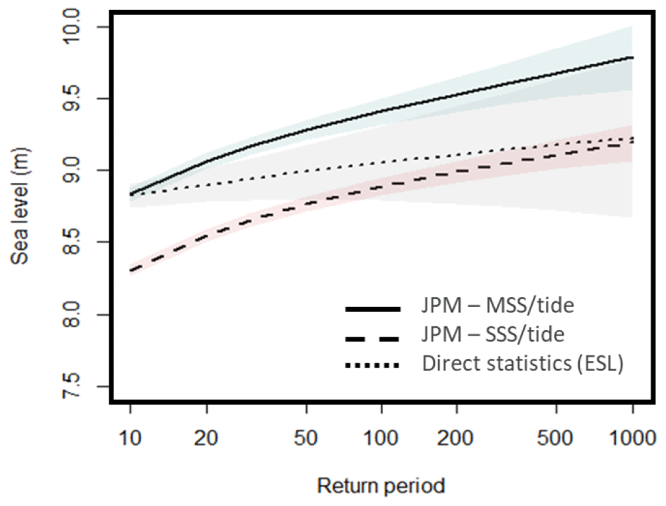
Timescale of emergence of chronic flooding in the major economic center of Guadeloupe
Sea-level rise due to anthropogenic climate change is projected not only to exacerbate extreme events such as cyclones and storms but also to cause more frequent chronic flooding occurring at high…