Rechercher
Intertidal topography mapping using the waterline method from Sentinel-1 & -2 images: The examples of Arcachon and Veys Bays in France
Intertidal flats lying as a buffer zone between land and sea provide critical services including protection against storm surges and coastal flooding. These environments are characterized by a…

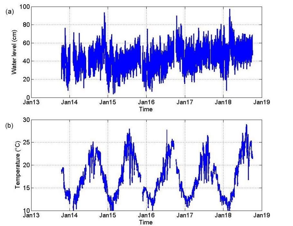
On the use of long term observation of water level and temperature along the shore for a better understanding of the dynamics: Example of Toulon area, France
A dense network of instruments has been deployed within harbors along the Mediterranean coast, in the Toulon Metropole area, between the Hyères islands and the Sanary Bay in the framework of the…
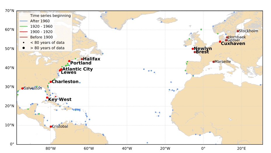
Climate-scale changes of the semidiurnal tide over the North Atlantic coasts from 1846 to 2018
We investigated the long-term changes of the principal tidal component M₂ over the North Atlantic coasts, from 1846 to 2018. We analysed 9 tide gauges with time series starting no later than 1920…
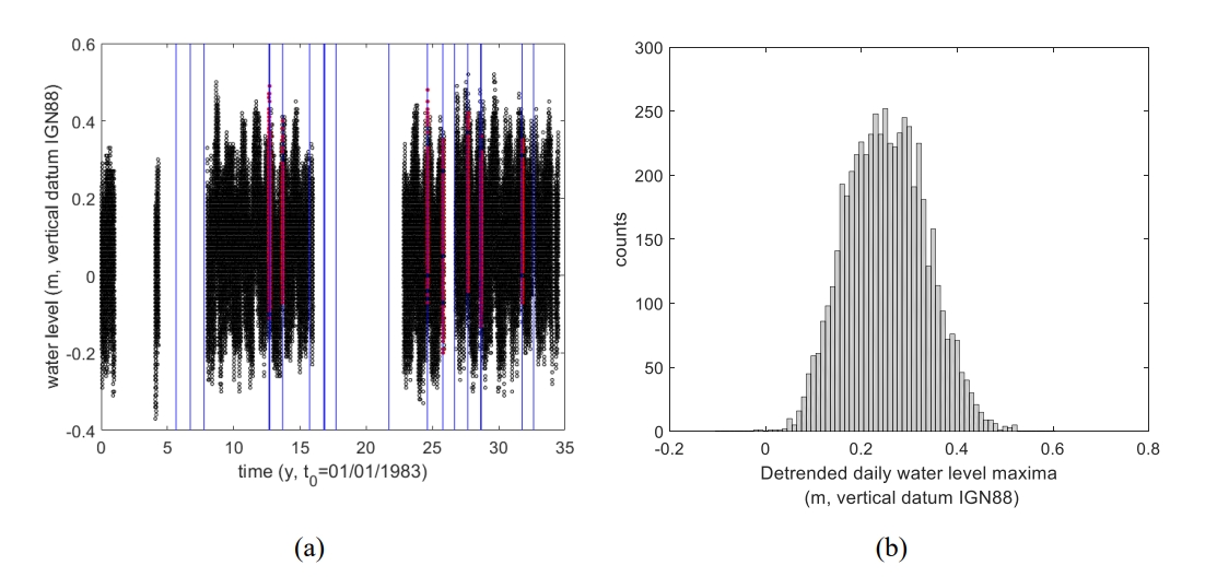
The Seasonal Cycle of Mean Sea Level in the North East Atlantic Ocean
The analysis of long-term tide gauge data collected in the Northeast Atlantic Ocean reveals that the seasonal cycle of mean sea level (hereafter MSL) exhibits amplitudes of up to 0.4 m. The…

Timescales of emergence of chronic nuisance flooding in the major economic centre of Guadeloupe
Chronic flooding, occurring at high tides under calm weather conditions, is occasionally taking place today in the low-lying areas of the Petit-Cul-de-sac marin (Guadeloupe, West Indies,…
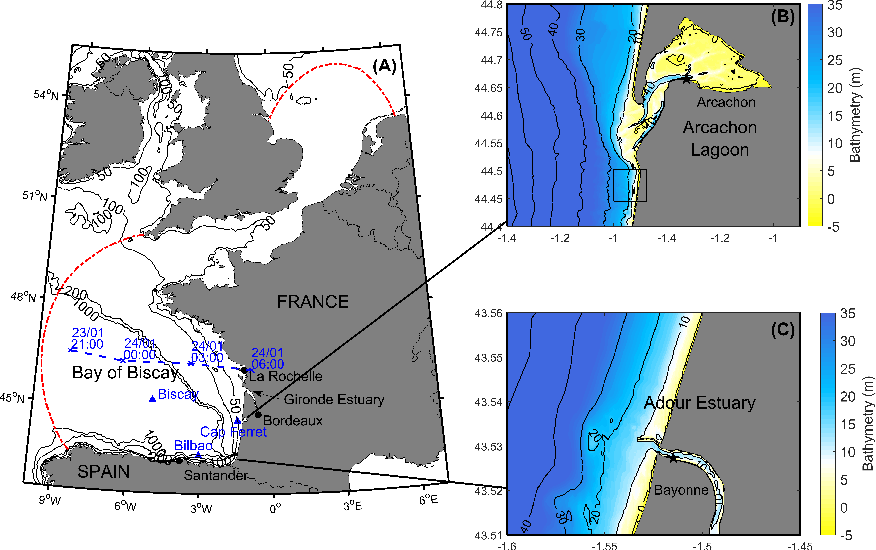
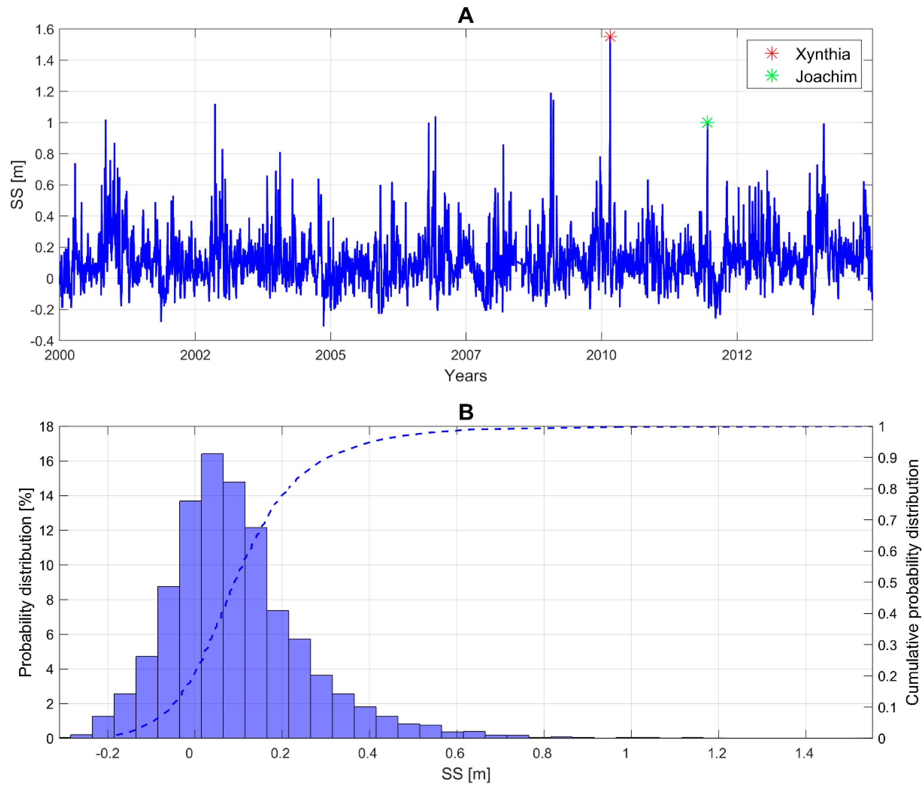
The contribution of short-wave breaking to storm surges: The case Klaus in the Southern Bay of Biscay
This study investigates the contribution of short-wave breaking to storm surges through a high-resolution hindcast of the sea state and storm surge associated with the extra-tropical storm Klaus.…
Influence des modifications morphologiques de l'avant-côte sur l'hydrodynamisme et l'évolution du littoral des Hauts-de-France depuis le XIXe siècle
Dans les environnements côtiers, les interactions entre les processus morphodynamiques, océanographiques et anthropiques (agissant sur différentes échelles de temps) contrôlent l'évolution des…
Statistical Prediction of Extreme Storm Surges Based on a Fully Supervised Weather-Type Downscaling Model
Increasing our capacity to predict extreme storm surges is one of the key issues in terms of coastal flood risk prevention and adaptation. Dynamically forecasting storm surges is computationally…
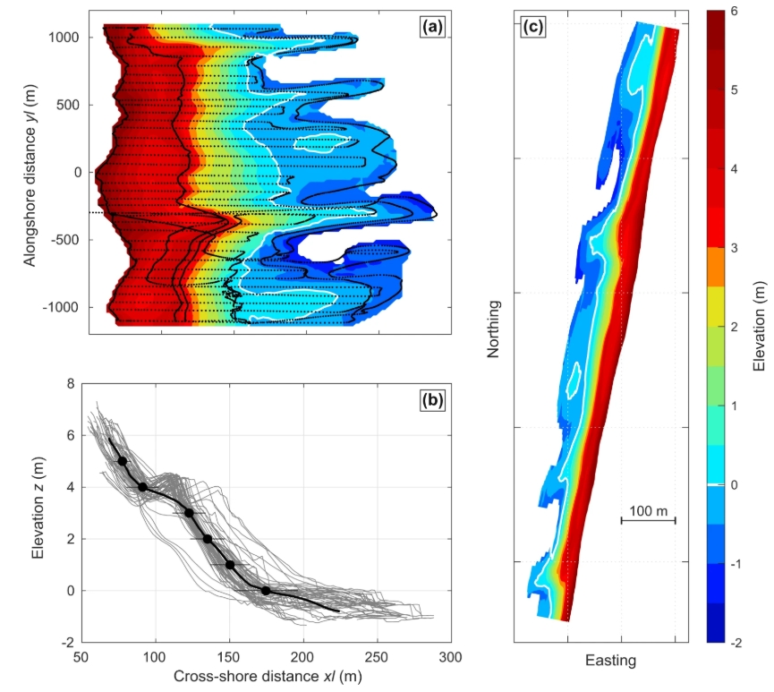
16 years of topographic surveys of rip-channelled high-energy meso-macrotidal sandy beach
Sandy beaches are highly dynamic environments buffering shores from storm waves and providing outstanding recreational services. Long-term beach monitoring programs are critical to test and…
Influence of biofouling on the mooring tension of the COAST-HF Iroise monitoring buoy
The COAST-HF_Marel-Iroise station is a scientific floating platform in the Ifremer in situ test site of Sainte Anne du Portzic equipped with various sensors to monitor the local metocean…