Rechercher
Nonlinear dynamics of the sea level time series in the eastern English Channel
Coastal flooding due to surge events represents natural hazards with huge potential consequences for coastal regions. Sea level time series display variations on a large range of timescales, with…
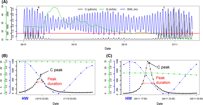
Short-term forecasting of saltwater occurrence at La Comté River (French Guiana) using a kernel-based support vector machine
Saltwater intrusion into rivers is a major concern for freshwater exploitation and management in French Guiana (South America). To detect and analyse saltwater occurrence, a permanent station was…
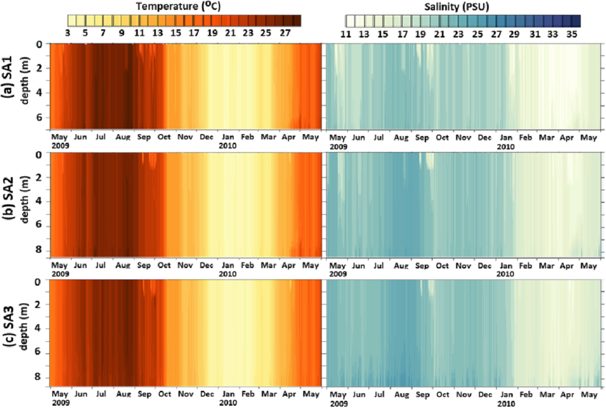
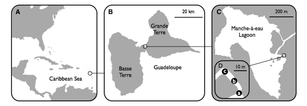
Temporal fluctuations in the trophic role of large benthic sulfur bacteria in mangrove sediment
Filamentous sulfur bacteria of the genus Beggiatoa form large mats covering the sediment in the shallow waters of a Guadeloupean mangrove (French West Indies). The abundance of these…
Managed realignment to mitigate storm-induced flooding: A case study in La Faute-sur-mer, France
Storm-induced coastal flooding is among the most destructive natural disasters while climate change together with increased populations along the coast will enhance the associated risk. This study…

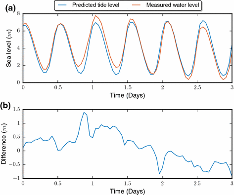
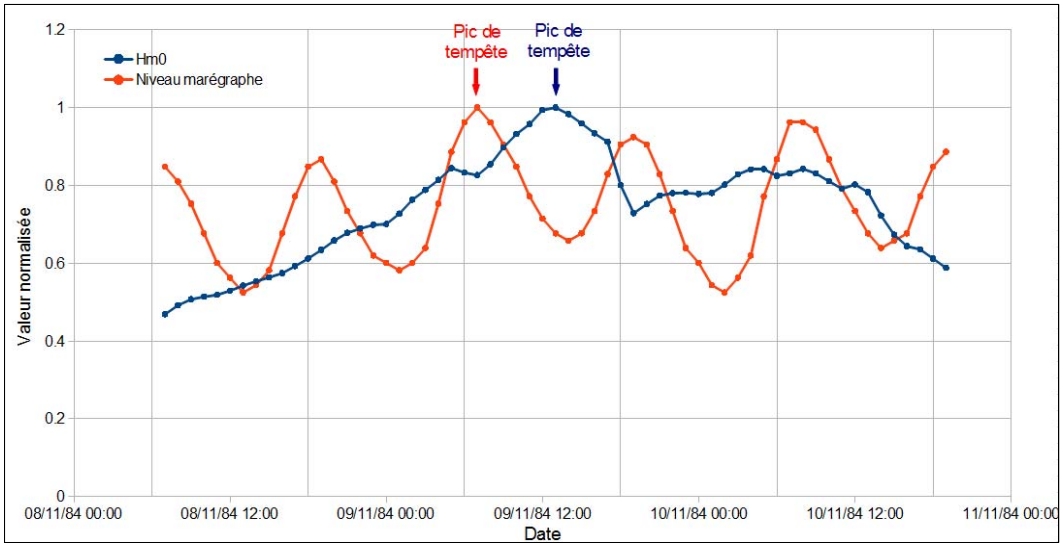
Analyse des niveaux d'eau avec l'action des vagues au droit d'une plage de Méditerranée
La façade maritime méditerranéenne est bordée par plusieurs départements littoraux sur lesquels des enjeux de gestion du Domaine Public Maritime naturel (DPM) forts existent. La délimitation du…
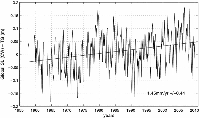
Historical Sea Level in the South Pacific from Rescued Archives, Geodetic Measurements, and Satellite Altimetry
Automatic sea-level measurements in Nouméa, South Pacific, started in 1957 for the International Geophysical year. Data from this location exist in paper record for the 1957–1967 period, and in…
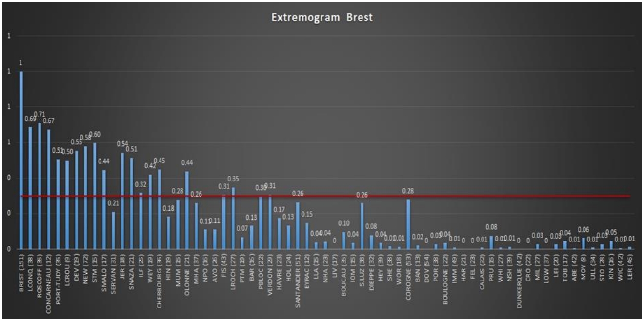
Homogenous regions based on extremogram for regional frequency analysis of extreme skew storm surges
To resist marine submersion, coastal protection must be designed by taking into account the most accurate estimate of the return levels of extreme events, such as storm surges. However, because of…
A case study on the growth of Lanice conchilegas (Pallas, 1766) aggregations and their ecosystem engineering impact on sedimentary processes
Ecosystem engineers are organisms that modulate natural resources enabling the survival of other species. They drive environmental change and contribute to several coastal functional attributes…

The effect of wind induced bottom shear stress and salinity on Zostera noltii replanting in a Mediteerranean coastal lagoon
The paper concerns the wind influence on bottom shear stress and salinity levels in a Mediterranean semi-enclosed coastal lagoon (Etang de Berre), with respect to a replanting program of Zostera…