Rechercher
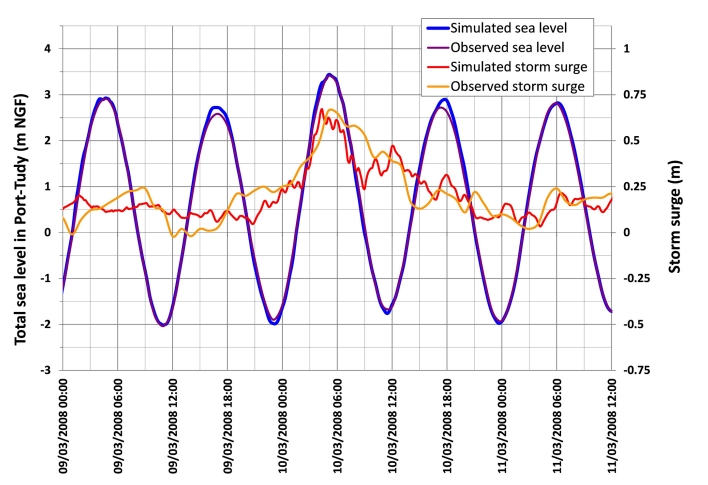
Coastal flooding of urban areas by overtopping: dynamic modelling application to the Johanna storm (2008) in Gâvres (France)
Recent dramatic events have allowed significant progress to be achieved in coastal flood modelling over recent years. Classical approaches generally estimate wave overtopping by means of empirical…
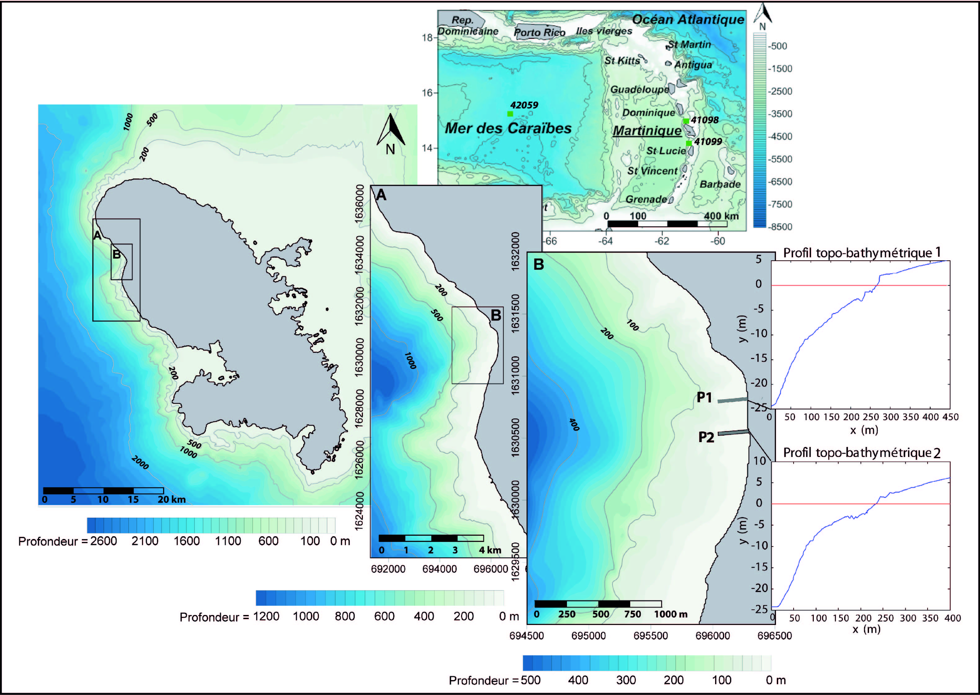
Modélisation des niveaux marins extrêmes associés à la circulation des cyclones Lenny (1999) et Omar (2008), commune de saint-pierre, littoral nord-ouest de la Martinique
Les submersions marines sont le plus souvent associées à des conditions météorologiques locales de tempête et aux phénomènes bien connus de surcote résultant du cumul de l’effet barométrique…
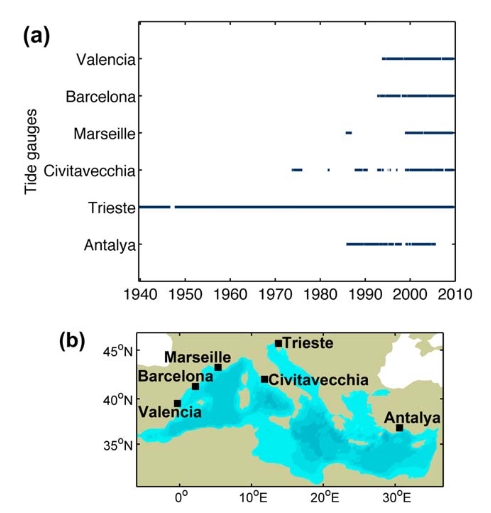
Improving the estimation of extreme sea levels by a characterization of the dependence of skew surges on high tidal levels
The knowledge of the statistical distribution of extreme sea levels at the coast is of utmost importance for the characterization of flood risks in coastal areas. In this study we consider that…
Ces tempêtes extrêmes que l'histoire ne nous a pas encore dévoilées
Les études d'aléa de submersion marine s'attachent à définir des valeurs extrêmes pour les niveaux marins et les houles et à combiner ces valeurs afin de produire un aléa de référence à la côte.…

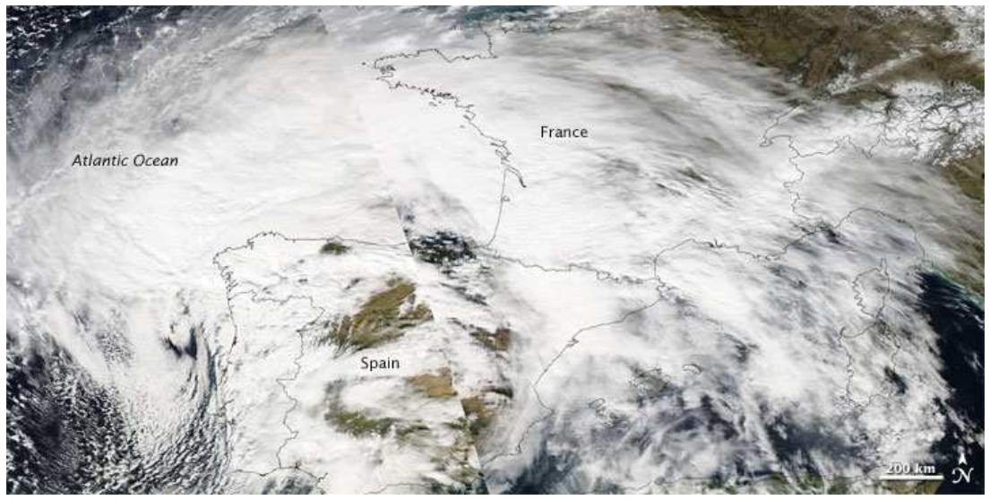
Sea level surges of June 2011 in the NE Atlantic Ocean: observations and possible interpretation
We present a synthesis of tide gauge data recorded on June 26–28, 2011, along the NE Atlantic and the English Channel coastlines, which show a significant sea level disturbance observed from…

GPS observation of geophysical deformations induced by non tidal loading
The temporal and spatial redistribution of the environmental masses deform the surface of the Earth. These deformations are observable by space geodetic techniques such as GNSS. Since highly…
Effects of waves on coastal water dispersion in a small estuarine bay
A three-dimensional wave-current model is used to investigate wave-induced circulations in a small estuarine bay and its impact on freshwater exchanges with the inner shelf, related to stratified…
The ability of a barotropic model to simulate sea level extremes of meteorological origin in the Mediterranean Sea, including those caused by explosive cyclones
Storm surges are responsible for great damage to coastal property and loss of life every year. Coastal management and adaptation practices are essential to reduce such damage. Numerical models…
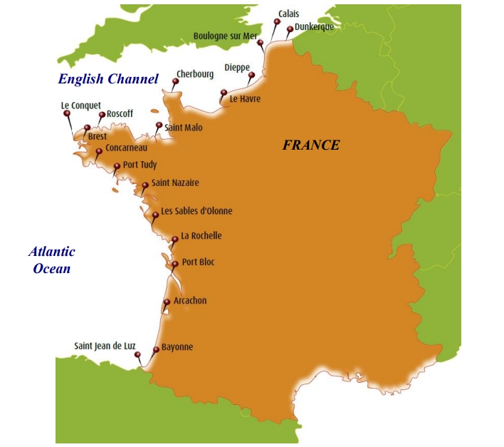
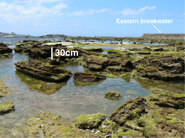
How frequent is storm-induced flooding in the central part of the Bay of Biscay?
This study analyzes historical archives to produce a database of storm-induced coastal flooding in the French central part of the Bay of Biscay since 1500 AD. From this new database, 46 coastal…

Using high sampling rate (10/20 Hz) altimeter data for the observation of coastal surface currents: A case study over the northwestern Mediterranean Sea
Satellite altimetry, measuring sea surface heights (SSHs), has unique capabilities to provide information about the ocean dynamics. In this paper, the skill of the original full rate (10/20 Hz)…