Rechercher
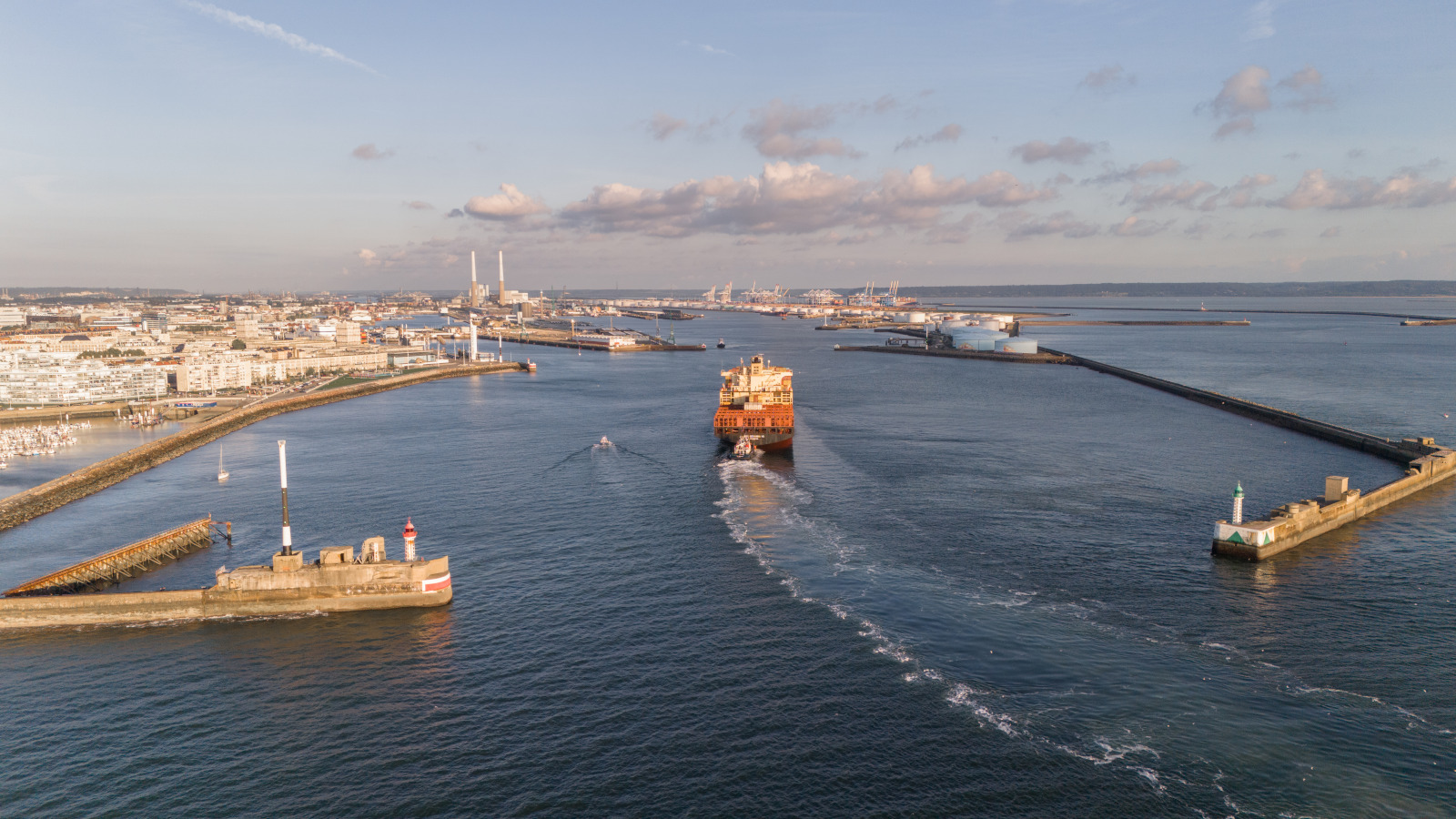
HAROPA PORT poursuit sa collaboration avec REFMAR en ouvrant l'accès aux données marégraphiques du Havre
Après Rouen, HAROPA PORT ouvre l’accès à ses mesures du niveau de mer pour Le Havre. Désormais, ses données marégraphiques sont accessibles sur le portail de référence data.shom.fr, complétant la…
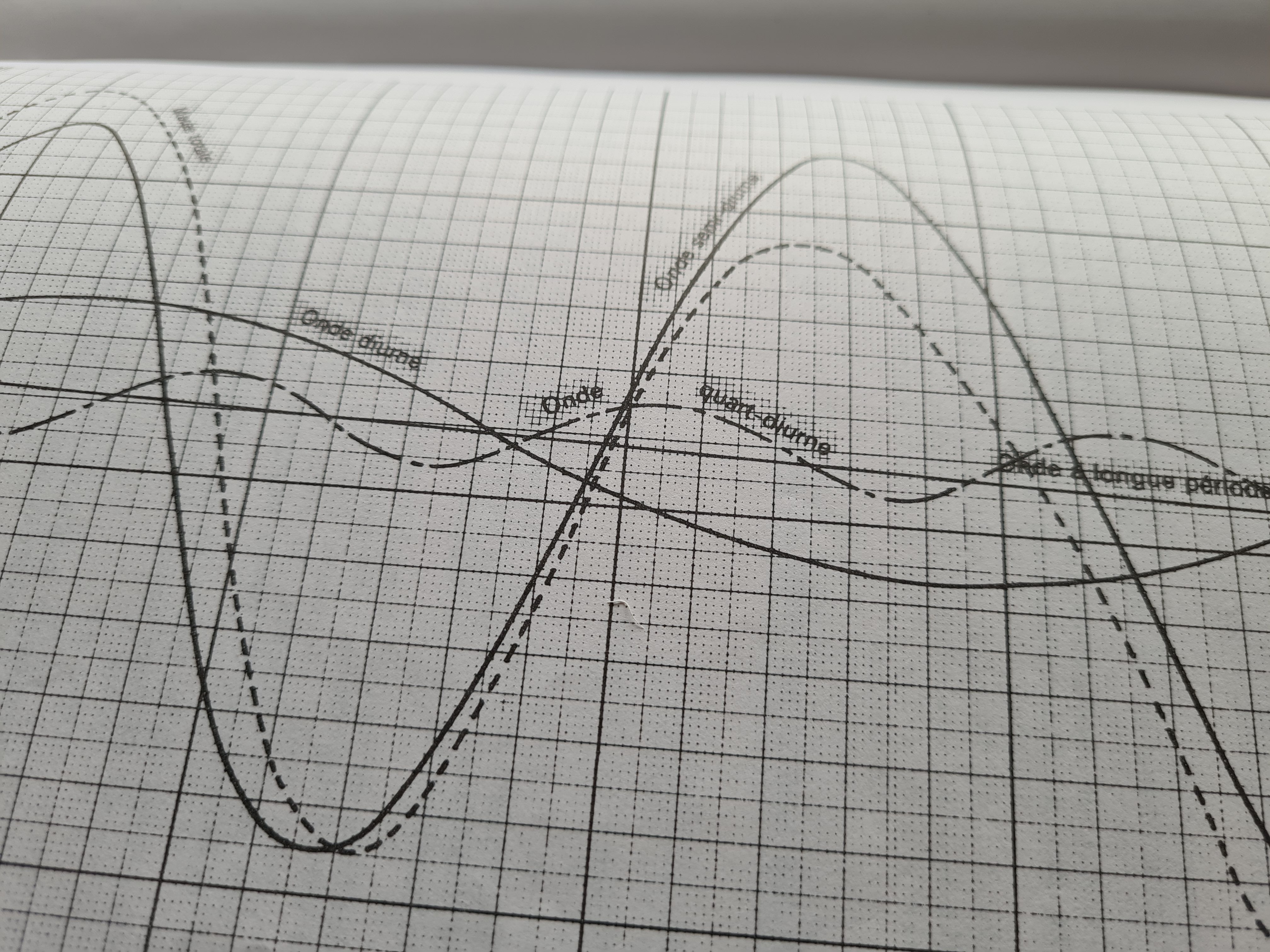
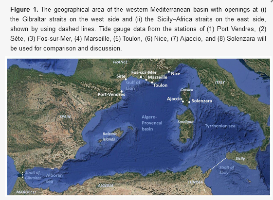
An SWE-FEM Model with Application to Resonant Periods and Tide Components in the Western Mediterranean Sea Region
A FEM model of Shallow Wave Equations (SWE-FEM) is studied, taking into account the variable bathymetry of semi-enclosed sea basins. The model, with a spatially varying Coriolis term, is…
Reconstruction de la série marégraphique historique d’Antsiranana (Diego-Suarez) à Madagascar
Ce stage s’inscrit dans le cadre des activités de valorisation des archives marégraphiques, visant à reconstituer et diffuser une série chronologique du niveau de la mer pour Antsiranana (…
Certification CoreTrustSeal pour l'entrepôt de données Shom - « Observatoires permanents du niveau de la mer »
Depuis le 18 juin 2025 le Shom est certifié entrepôt de données digne de confiance (Trustworthy Data Repository) par l’organisation internationale CoreTrustSeal pour le périmètre « Observatoires…
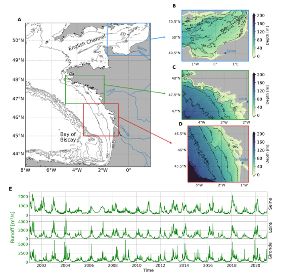
Temporal scales of variability in Regions Of Freshwater Influence on the French continental shelf over two decades
The Regions Of Freshwater Influence (ROFIs) are defined as the area on the continental shelf in the vicinity of estuaries, where freshwater from the river significantly influence water properties…
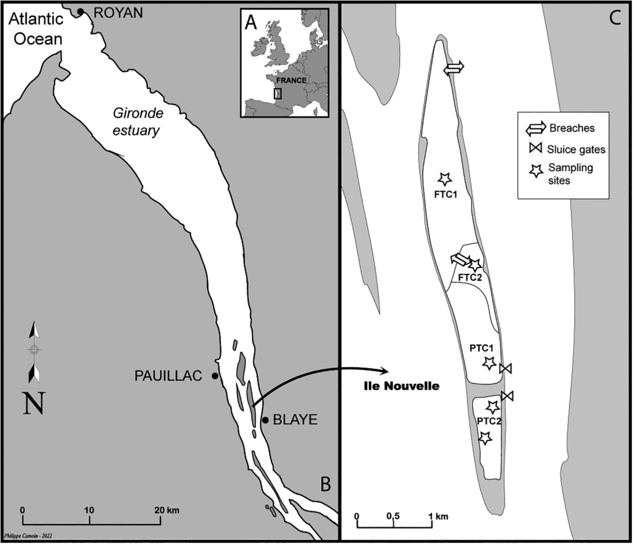
Aquatic food webs in restored marshes: a stable-isotope approach in the Gironde estuary (SW France)
Intertidal marshes are important habitats for nekton. However, historical draining and dyking hampered European coastal wetlands. Marsh restoration is therefore critical not only to improve their…
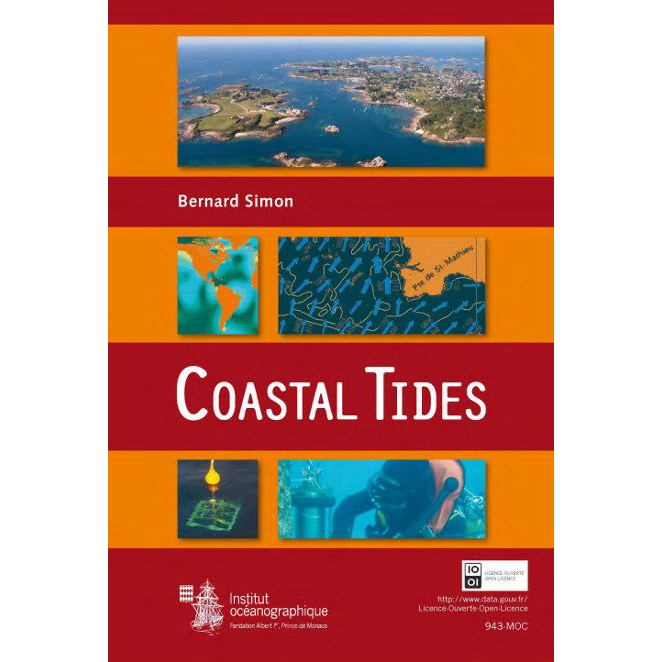
Coastal Tides
Chapters detail tidal theory, tide gauges measurements, techniques of tidal signal treatment. The book provides also an overview of some applications like barotropic tidal current. A French and an…
Supports TIPE
Cette page rassemble des éléments pouvant aider les élèves souhaitant réaliser leur travail d'initiative personnelle encadré (TIPE) ou leur projet de fin d'études (PFE) sur le thème du phénomène…