Rechercher
Evénement Herminia du 2025-01-25 au 2025-01-28
La carte ci-dessous présente les hauteurs de surcotes de pleines mers maximales enregistrées. Les résultats sont issus de calculs automatiques non expertisés à partir de données d'…
Plénière du GT Tempêtes et Submersions Historiques les 11 et 12 mars 2025
La réunion plénière du groupe de travail Tempêtes et Submersions Historique a lieu une fois par an. Elle permet aux membres du Groupe de travail tempêtes et submersions historiques de se réunir et…
Morphological feedback between nearshore bars and shoreline dynamics during storm events – video observations at Sète beach, France
Cuspate shoreline or megacusps, having alongshore lengths of 100-1000 m, are features widely described, and several theories were proposed for their formation and evolution (edge waves, self-…
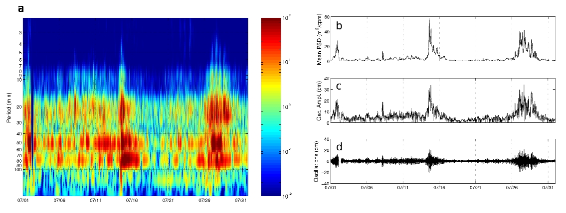
Detection method of Meteotsunami events and characterization of harbour oscillations in Western Mediterranean
A detection algorithm aimed at analysing localized intermittent oscillations in sea level time series and identifying meteotsunami events is presented. The algorithm is based on wavelet analysis…
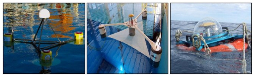
Measuring Sea Level with GPS-Equipped Buoys: A Multi-Instruments Experiment at Aix Island
Measuring sea-level in a global reference frame with sub-centimeter accuracy is a relevant challenge in the context of current global warming and associated sea-level rise. Global Navigation…
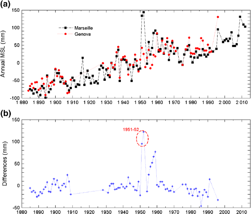
Rescue of the historical sea level record of Marseille (France) from 1885 to 1988 and its extension back to 1849–1851
This paper describes the historical sea level data that we have rescued from a tide gauge, especially devised originally for geodesy. This gauge was installed in Marseille in 1884 with the primary…
New insights on the tsunami recording of the May, 21, 2003, Mw 6.9 Boumerdès earthquake from tidal data analysis
We analyzed sea level data from a set of tide gauge stations located in the central and western Mediterranean Sea, that recorded the tsunami generated by the Mw 6.8 Boumerdès earthquake striking…

Fortnightly tidal asymmetry inversions and perspectives on sediment dynamics in a macrotidal estuary (Charente, France)
Tidal asymmetry is a phenomenon that characterises estuarine hydrodynamics and has a strong impact on sediment dynamics. Extensive research has been dedicated to studying tidal dynamics in…

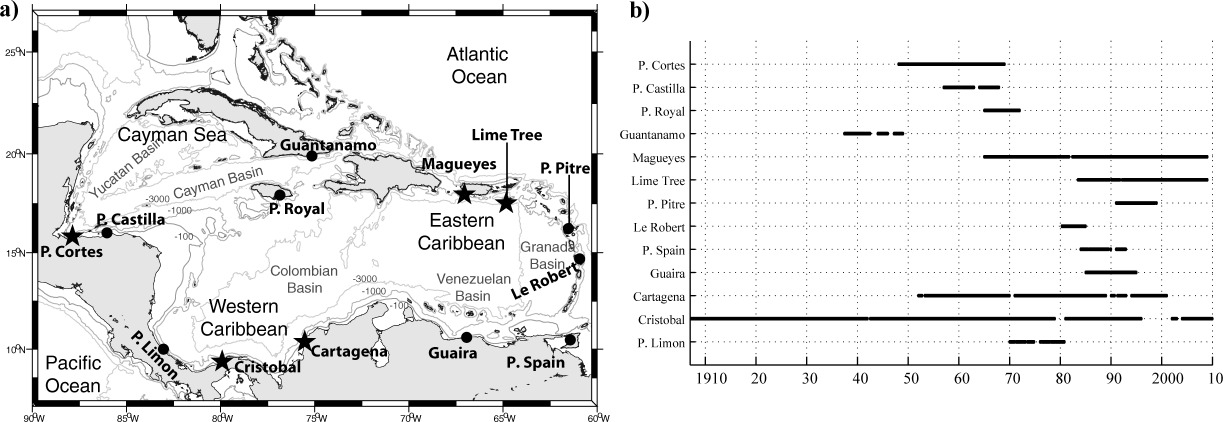
Sea level extremes in the Caribbean Sea
Sea level extremes in the Caribbean Sea are analyzed on the basis of hourly records from 13 tide gauges. The largest sea level extreme observed is 83 cm at Port Spain. The largest nontidal…
Storm impact on the seasonal shoreline dynamics of a meso- to macrotidal open sandy beach (Biscarrosse, France)
A three-year dataset (2007–2010) of shoreline and sandbar positions derived from video observations of an open sandy beach (Biscarrosse, France) is analyzed, to explore the impact of storms on the…