Rechercher
How historical information can improve estimation and prediction of extreme coastal water levels: application to the Xynthia event at La Rochelle (France)
The knowledge of extreme coastal water levels is useful for coastal flooding studies or the design of coastal defences. While deriving such extremes with standard analyses using tide-gauge…
The contribution of short-waves in storm surges: Two case studies in the Bay of Biscay
This study investigates the contributions of short waves in storm surges through the hindcast of two storms that hit the central part of the Bay of Biscay recently. Despite displaying comparable…

Tidal notches in Mediterranean Sea: a comprehensive analysis
Recent works (Evelpidou et al., 2012) suggest that the modern tidal notch is disappearing worldwide due sea level rise over the last century. In order to assess this hypothesis, we measured modern…
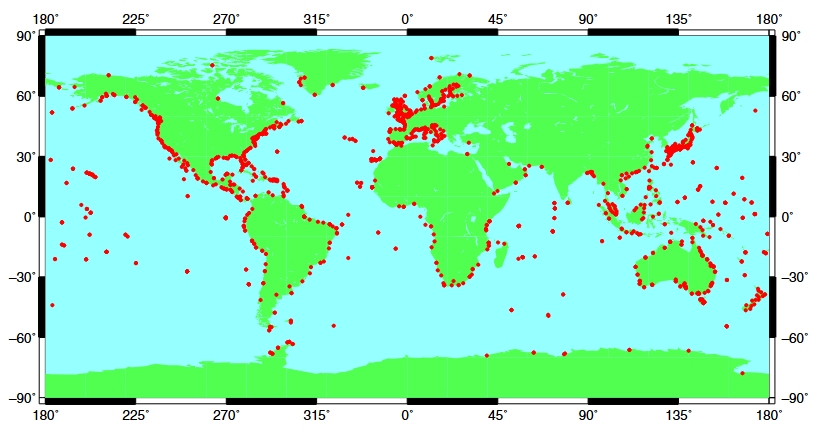
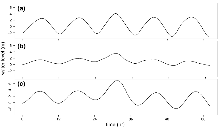
Towards a global higher-frequency sea level dataset
This paper describes the assembly of an updated quasi-global dataset of higher-frequency sea level information obtained from tide gauges operated by many agencies around the world. We believe that…
Hyper-resolution mapping of regional storm surge and tide flooding: comparison of static and dynamic models
Storm tide (combination of storm surge and the astronomical tide) flooding is a natural hazard with significant global social and economic consequences. For this reason, government agencies and…
Hail observations and hailstorm characteristics in Europe: a review
Severe thunderstorms associated with large hail are among the most important perils in several European regions. Due to the local-scale extent of hail-affected areas and a lack of appropriate…

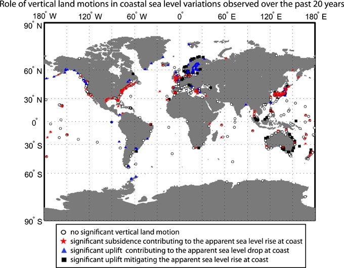
The key role of vertical land motions in coastal sea level variations: A global synthesis of multisatellite altimetry, tide gauge data and GPS measurements
This study aims to quantify the vertical motions driving the decadal coastline mobility and their uncertainty at global scale. Multisatellite altimetry is combined with tide gauges and Global…
FAQ (en cours de construction)
Cette rubrique recense des réponses aux questions fréquemment posées par les visiteurs et usagers du portail REFMAR.
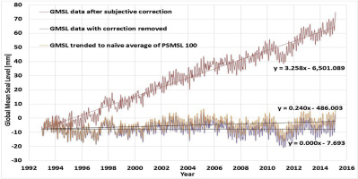
Coastal planning should be based on proven sea level data
There are two related measures of sea level, the absolute sea level, which is the increase in the sea level in an absolute reference frame, and relative sea level, which is the increase in sea…
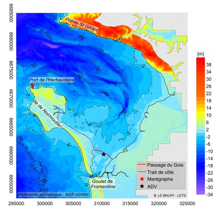
Analyse des mécanismes d'érosion le long du passage du Gois, Vendée
Le Passage du Gois est une chaussée submergée à chaque marée. Il permet de relier le continent à l’île de Noirmoutier à marée basse en traversant la Baie de Bourgneuf. L’érosion constatée le long…