Rechercher
A modeling-based analysis of the flooding associated with Xynthia, central Bay of Biscay
Storm-induced coastal flooding is among the most destructive natural disasters, as seen recently in the Bay of Bengal, the Gulf of Mexico and the Philippines. This study presents a high resolution…

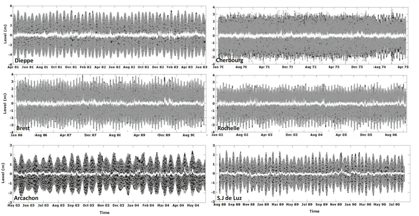
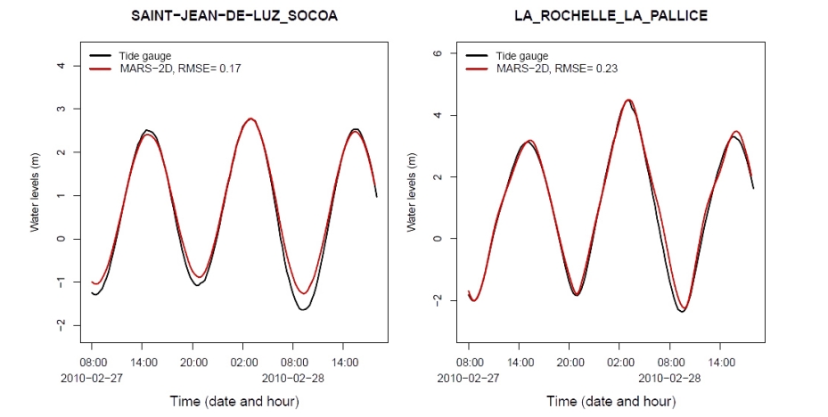
A new hybrid model for filling gaps and forecast in sea level: application to the eastern English Channel and the North Atlantic Sea (western France)
This research is carried out in the framework of the program Surface Water and Ocean Topography (SWOT) which is a partnership between NASA and CNES. Here, a new hybrid model is implemented for…
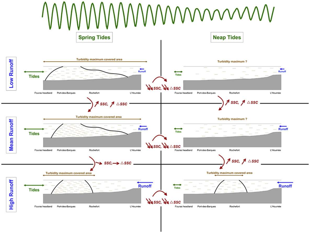
Formation and structure of the turbidity maximum in the macrotidal Charente estuary (France): Influence of fluvial and tidal forcing
Understanding estuarine sediment dynamics and particularly turbidity maximum dynamics is crucial for the management of these coastal systems. Various processes impact the formation, movement and…
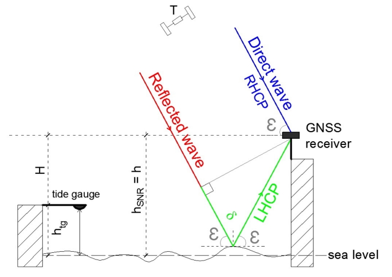
Sea level monitoring and sea state estimate using a single geodetic receiver
GNSS-Reflectometry (GNSS-R) altimetry has demonstrated a strong potential for sea level monitoring. Interference Pattern Technique (IPT) based on the analysis of the Signal-to-Noise Ratio (SNR)…
Wave spectra partitioning and long term statistical distribution
A new method is presented for a physically based statistical description of wind wave climatology. The method applies spectral partitioning to identify individual wave systems (partitions) in time…
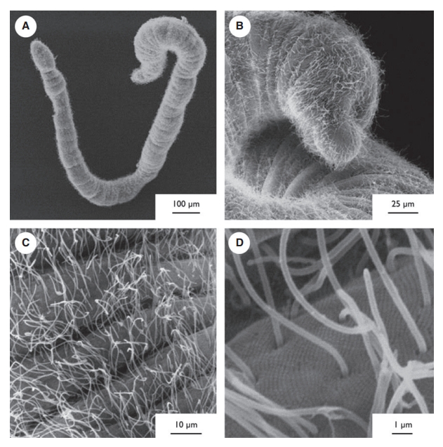
Diet of Haplognathia ruberrima (Gnathostomulida) in a Caribbean marine mangrove
Haplognathia ruberrima is a cosmopolitan gnathostomulid species found in sulfur bacterial mats in mangroves in Guadeloupe (French West Indies). Haplognathia ruberrima presents a δ13C…
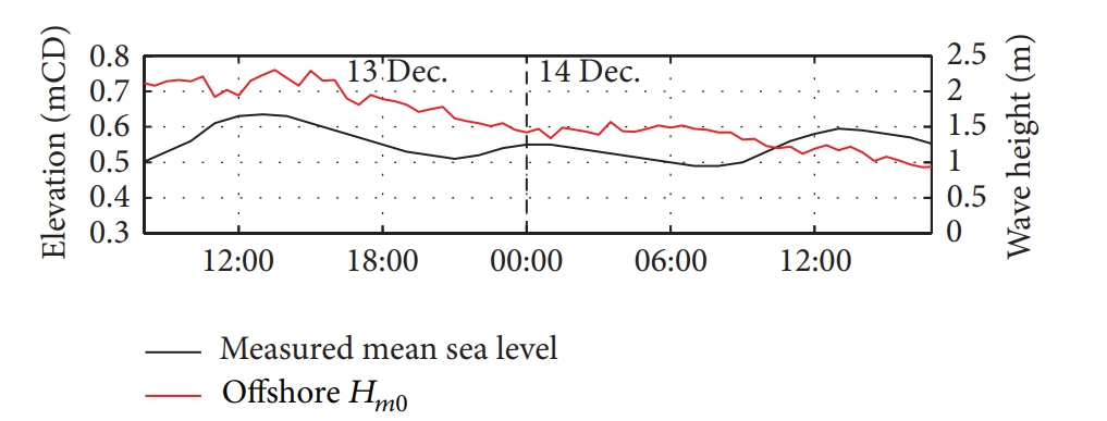
Estimation of insurance-related losses resulting from coastal flooding in France
A model has been developed in order to estimate insurance-related losses caused by coastal flooding in France. The deterministic part of the model aims at identifying the potentially flood-…
Monitoring individual wave characteristics in the inner surf with a 2-Dimensional laser scanner (LiDAR)
This paper presents an investigation into the use of a 2-dimensional laser scanner (LiDAR) to obtain measurements of wave processes in the inner surf and swash zones of a microtidal beach (Rousty…
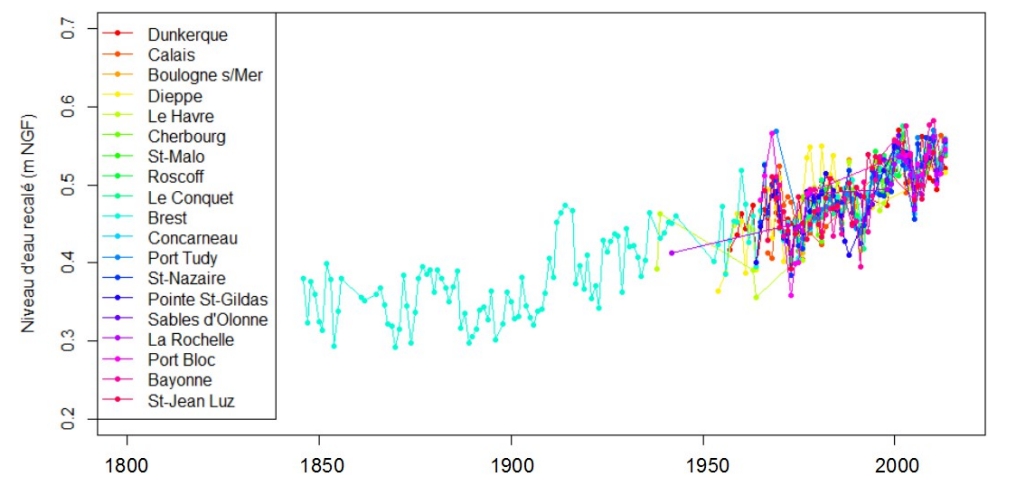
Estimation des niveaux marins extrêmes avec et sans l’action des vagues le long du littoral métropolitain
Pour caractériser le risque de submersion marine, il est très important d'avoir une connaissance précise des lois de distribution des niveaux d'eau marins, et plus particulièrement des niveaux d'…
Regional circulation around New Caledonia from two decades of observations
The regional and near-coastal circulation around New Caledonia is investigated using a compilation of more than 20 years of observations. Velocity profiles acquired by Shipboard Acoustic Doppler…