Rechercher
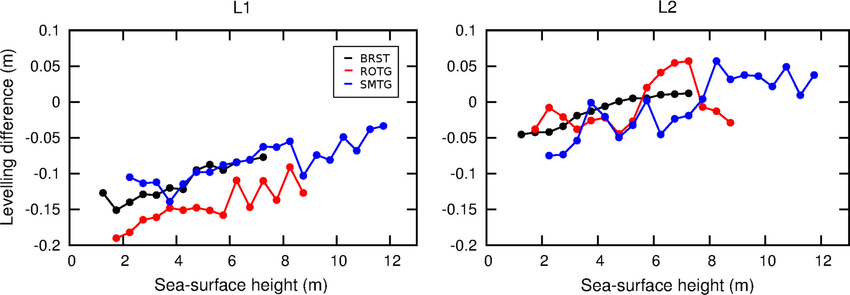
Levelling co-located GNSS and tide gauge stations using GNSS reflectometry
The GNSS reflectometry technique provides geometric information on the environment surrounding the GNSS antenna including the vertical distance to a reflecting surface. We use sea-surface…
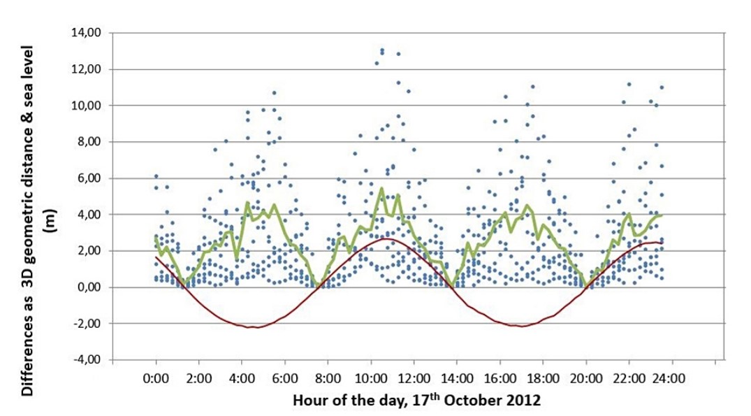
Simulations of direct and reflected wave trajectories for ground-based GNSS-R experiments
The detection of Global Navigation Satellite System (GNSS) signals that are reflected off the surface, along with the reception of direct GNSS signals, offers a unique opportunity to monitor water…
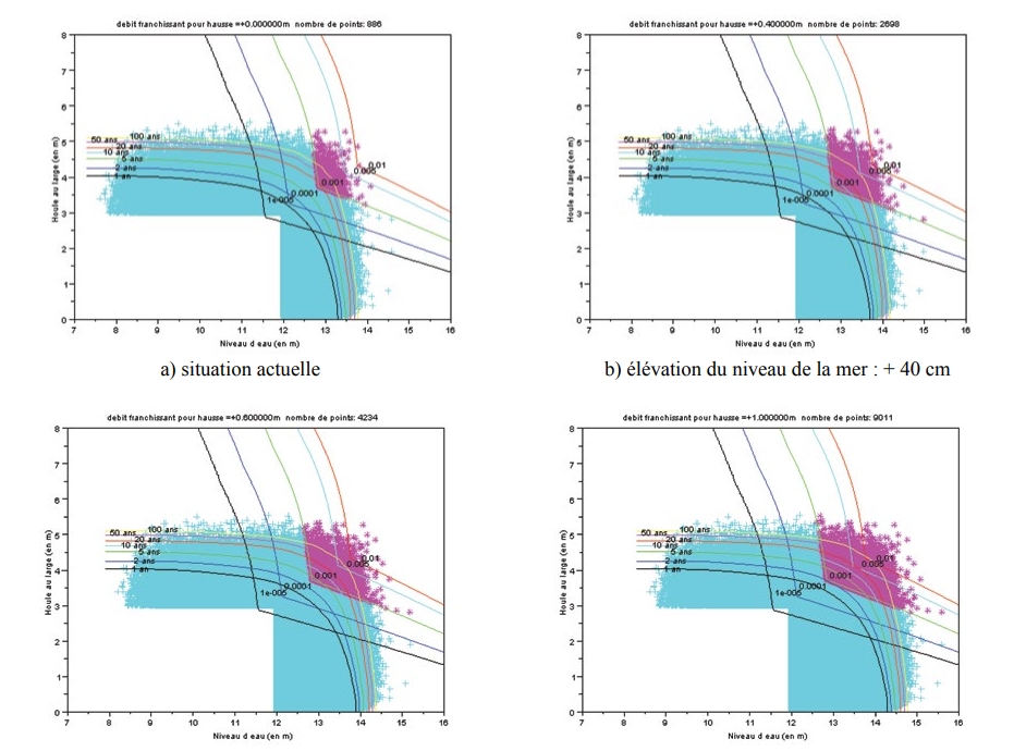
Évolution des périodes de retour des évènements franchissant avec le changement climatique
L'une des conséquences du changement climatique est la remontée du niveau moyen des mers. C'est cette conséquence qui est prise pour hypothèse principale dans ce travail. La méthode utilisée pour…
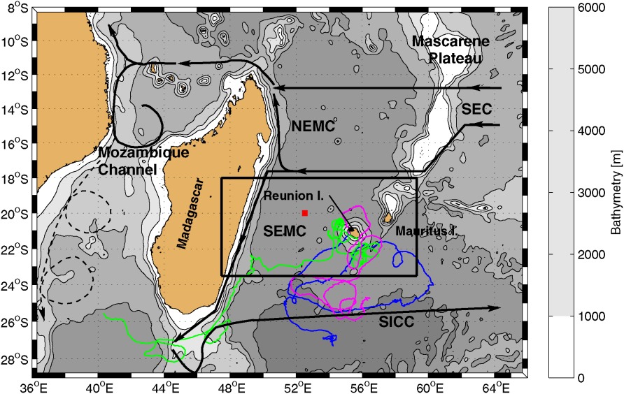
Circulation around La Réunion and Mauritius islands in the South-Western Indian Ocean: a modeling perspective
The objective of this study is to document the circulation in the vicinity of La Réunion and Mauritius islands, i.e., within 500 km offshore, on the intraseasonal time scale, using a high-…
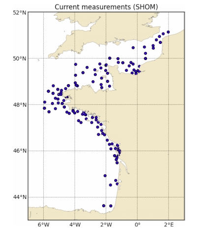
PREVIMER: Improvement of surge, sea level and currents modelling
The pre-operational system PREVIMER provides coastal observations and forecasts along French coasts. It provides, among other variables, currents, sea levels, surges and waves. This paper…
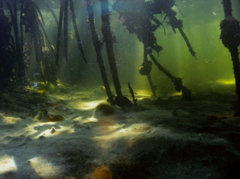
Trophic role of large benthic sulfur bacteria in mangrove sediment
Large filamentous sulfur-oxidizing bacteria belonging to the Beggiatoacae family can cover large portions of shallow marine sediments surrounding mangroves in Guadeloupe (French West Indies). In…
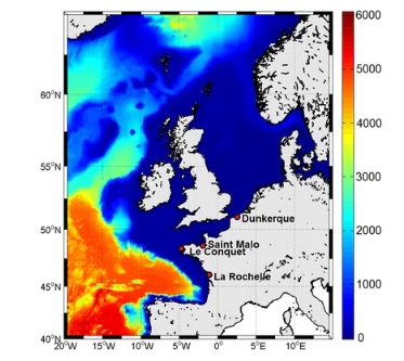
Atmospheric storm surge modeling methodology along the French (Atlantic and English Channel) coast
Storm surge modeling and forecast are the key issues for coastal risk early warning systems. As a general objective, this study aims at improving high-frequency storm surge variations modeling…
Applying POT methods to the Revised Joint Probability Method for determining extreme sea levels
Newly exposed concepts of POT declustering (Bernardara et al., 2014) within the GPD-Poisson model are applied to the joint probability of tide and surge for determining extreme sea levels, as a…

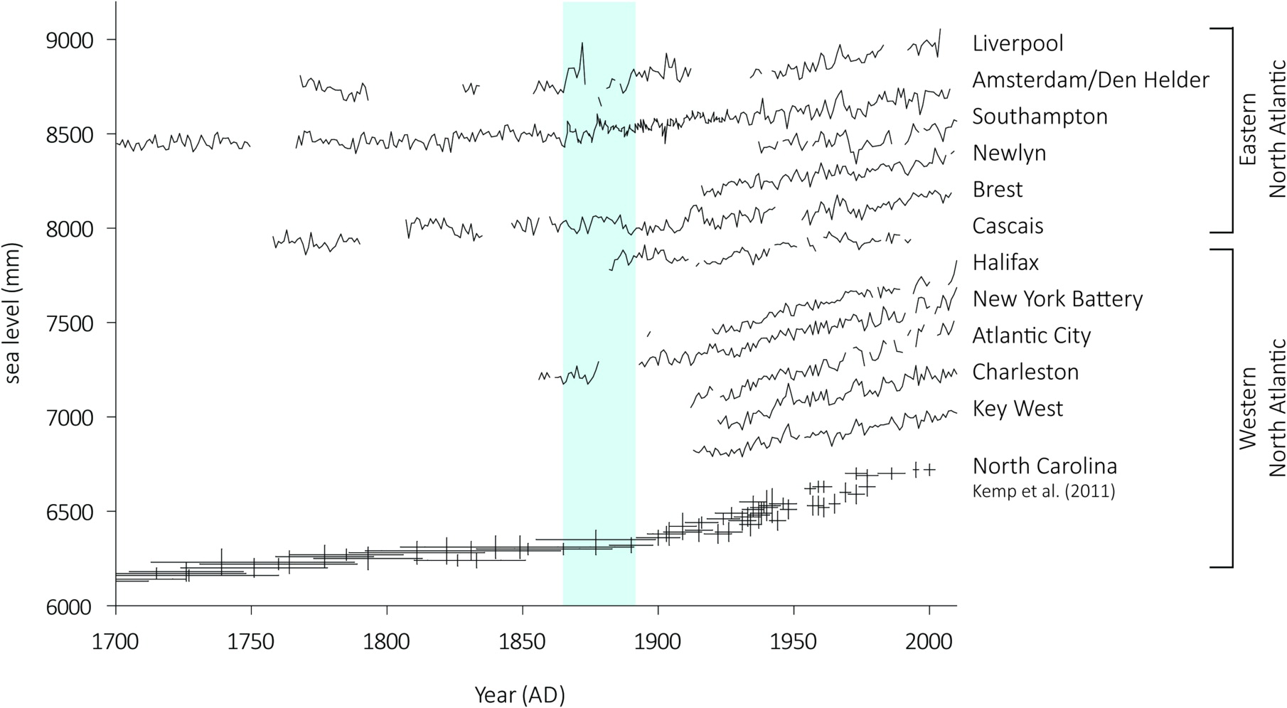
Contrasting records of sea-level change in the eastern and western North Atlantic during the last 300 years
We present a new 300-year sea-level reconstruction from a salt marsh on the Isle of Wight (central English Channel, UK) that we compare to other salt-marsh and long tide-gauge records to examine…
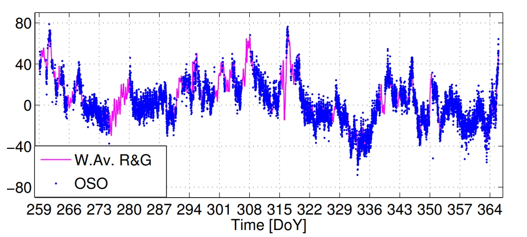
Sea level time series and ocean tide analysis from multipath signals at five GPS sites in different parts of the world
We present sea level observations derived from the analysis of signal-to-noise ratio (SNR) data recorded by five coastal GPS stations. These stations are located in different regions around the…